- [email protected]
- +971 50 5932 535
- +971 56 7848 983
KPB, through its enspecialized drone division
, boasts two decades of proven international expertise in aerial surveying and geospatial data.
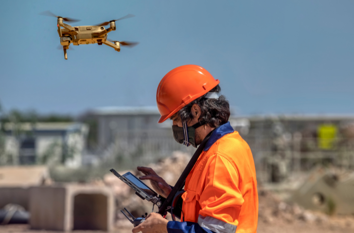
By using drones for surveying purposes, there is no need to halt operations or shut down plants, resulting in significant time and cost savings.
Drones can reach closer proximity to surveying targets compared to manned helicopters, resulting in higher data density and superior survey outcomes. With faster data acquisition and enhanced data resolution, it is evident why drones and drone specialists are crucial for commercial, industrial, and infrastructure projects, including those in the rail, oil, gas, telecommunications, and renewable technology sectors.
KPB, through its specialized drone division , boasts two decades of proven international expertise in aerial surveying and geospatial data. The skilled team serves diverse industries worldwide, providing top-quality imagery, analytics, and reporting using state-of-the-art cloud-based software.
Our team consists of experienced and diverse professionals who bring invaluable skills to our work. We have experts in surveillance, software development, business analysis, cartography, pipeline engineering, survey piloting, and unmanned aerial vehicle (UAV) and LiDAR operations. This diverse expertise allows us to offer innovative solutions to unique challenges. We guarantee efficient international coverage in an expanding market, ensuring that the quality and consistency of our services are unmatched wherever we operate.